


.svg)


.png)


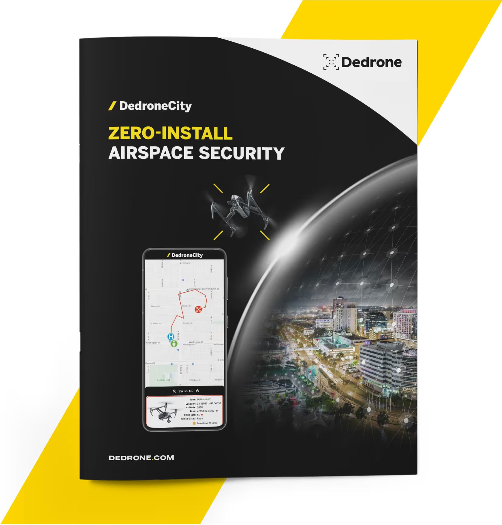
DedroneCity allows organizations to instantly access drone data in their airspace without needing to install or maintain hardware. Users can easily mark alert zones and receive real-time notifications when drones enter detection areas.

Email Notifications
Instant notification to user defined email distribution lists for active drone intrusion information.
Text Alerts
Streamline your dispatch process with instant Text Alerts the moment your alert zone(s) are breached. User will receive notification as well as map link for Pilot’s GPS location.
Create Custom Email/Text Distribution Lists
Enable one or many to receive alert notifications utilizing our simplistic distribution platform.
Our global database of drone data includes over 430 million flights and three years of data. It records flights that breach critical alert zones, violate no-fly zones, trespass over national borders, and more.

Easily Monitor Live Drone Flights
A simple interface allows you
to monitor all critical drone data
in one screen.
Identify Drone S/N And Flight Data
Gain access to drone data such as model, serial #, Drone & Pilot location and altitude.
Monitor Multiple Geographic Areas
Easily monitor your area of
interest, or areas of interest
if using multiple sensors.
Quickly Identify Pilot Location
Instantly reveal the pilot’s real time GPS location.
Get Alert Zone Notifications
Get push notifications directly to your phone the moment an Alert Zone has been breached.
Add Comments To Drones Of Interest
Keep track of specific drones or flights and archive critical data through a simple tap and comment feature.

After serving as Chief of the FBI’s counter-UAS unit, I knew Dedrone was the ideal airspace security partner to protect people, property, and information from the persistent and escalating threat of drones in the
private sector.

Detecting the drone /pilot in your airspace is a prerequisite to neutralizing the threat and securing your airspace.

The Dedrone solution makes it possible to determine the height, route and, most importantly, the location of a drone’s remote pilot, which is essential for detecting any potential law-breaking. We will use Dedrone to ensure public safety, including during public events, in order to prevent violations, including those that may threaten the safety of the public.

We are pleased to answer the most important questions about urban airspace management. You are welcome to send us more questions.
City-wide drone detection refers to the deployment of advanced systems that monitor and identify unauthorized drone activities across an entire urban area, enhancing public safety and airspace security.
Urban airspace management is greatly enhanced by drone detection systems, which help authorities monitor, track, and respond to unauthorized drone flights, ensuring safer and more secure city environments.
Drone threat detection is crucial for public safety as it helps prevent unauthorized or malicious drone activities that could pose risks to urban areas, including critical infrastructure, events, and public spaces.
Counter-drone solutions for city-wide security utilize a combination of radar, radio frequency detection, and artificial intelligence to detect, track, and mitigate unauthorized drones, ensuring comprehensive airspace protection.
Drone surveillance enhances smart city initiatives by providing real-time monitoring and data collection, which can be used to improve urban planning, traffic management, and emergency response efforts.


